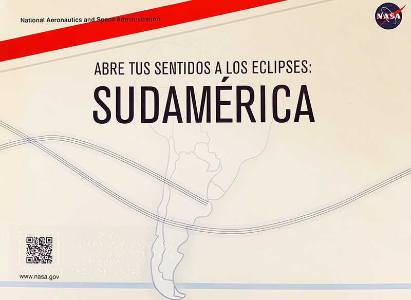
Solar Eclipses
For thousands of years, humans have observed the sky and had a sense
of wonder. Particular alignments of heavenly objects were seen as
signs or omens. Perhaps one of the most awe-inspiring and influential
celestial events to occur is a solar eclipse. In 2019 and 2020
significant solar eclipses occurred and were visible in South America
and one will be visible in the United States in 2024. While this
tactile book includes details surrounding the 2019 and 2020 eclipses,
much of the text and tactiles are relevant for future eclipses. Come
and explore the world of eclipses with us!
What is a solar eclipse?
A solar eclipse occurs when the Moon blocks the sunlight reaching the
Earth. It is important to understand some basics of the orbits of the
Earth and Moon. The Earth orbits, or revolves, about the Sun. It takes
about 365 days for the Earth to revolve once around the Sun. The Moon
orbits, or revolves, around the Earth and it takes about 29 ½ days for
the Moon to revolve once around the Earth with respect to the Sun
(referred to as the Moon’s Synodic Period of revolution). The Moon
orbits the Earth in nearly the same plane as the Earth and Sun. Every
29 ½ days the Moon passes between the Earth and the Sun in its orbit
(as shown on Tactile 1). This is called a “New Moon.” A solar eclipse
can only occur during the New Moon phase but it does not happen every
New Moon.
How often do solar eclipses occur?
Various types of eclipses occur four to seven times a year with most
years only having four. However, the type of eclipse being explored
with this book is known as a Total Solar Eclipse which occurs
somewhere on Earth about every 18 months. The problem is that an
observer is rarely in the right position on Earth (or within the path
of totality, reference Tactile 1 and Tactile 3) to witness the entire
disk of the Sun being blocked by the disk of the Moon (Tactile 2).
That path may only be about 80 to 170 km wide. It is so rare that if
the observer were to stay in one place on Earth, he/she would only be
found in the path of totality about once every 400 years!
You might be wondering why an eclipse does not occur every New Moon
which occurs every 29 ½ days. The reason is that the orbital plane of
the Moon and Earth is tilted by about 5° from the Earth and Sun’s
orbital plane. This causes the Moon’s shadow to usually fall either
above or below the earth.
How long do solar eclipses last?
“Totality,” or when the disk of the Sun is entirely
blocked by the disk of the Moon (Tactile 2), can last up to eight
minutes, though totality lasting about two to three minutes along the
so-called “path of totality” is much more common. Totality
for Chile and Argentina on July 2, 2019 and December 14, 2020 lasted
about 2 minutes. However, from the start of the eclipse, where the Sun
is partially eclipsed by the Moon, until the end of the eclipse, when
the disk of the Moon no longer blocks any of the Sun, took just over 2
hours in 2019 and nearly 3 hours in 2020 (as shown on Tactile 2).
To get an idea of the significant times involved during an eclipse,
the following tables comes from an interactive map highlighting the
2020 eclipse at Villarrica, Chile; Valcheta and
Piedra del Águila, Argentina. Although these examples
are for those towns specifically, a click on the map at any location
will give similar information. Below, you will find a link to the map
and other examples where the important information has been extracted.
Each example deals with the 2020 eclipse through Chile and Argentina,
but you are encouraged to explore the map for other locations and
other years.
Villarrica, Chile
|
Lat.: 39.2826° S
Long.: 72.227° W
|
Total Solar Eclipse
Duration of Totality: 2m08.7s
Magnitude: 1.012
Obscuration: 100.00%
|
|
Event
|
Date
|
Time (UT)
|
Alt
|
Azi
|
|
Start of partial eclipse (C1) :
|
2020/12/14
|
14:41:05.9
|
59.5°
|
067.5°
|
|
Start of total eclipse (C2) :
|
2020/12/14
|
16:02:49.6
|
71.8°
|
031.5°
|
|
Maximum eclipse :
|
2020/12/14
|
16:03:53.9
|
71.9°
|
030.8°
|
|
End of total eclipse (C3) :
|
2020/12/14
|
16:04:58.3
|
72.0°
|
030.1°
|
|
End of partial eclipse (C4) :
|
2020/12/14
|
17:31:02.8
|
71.1°
|
324.5°
|
This table has a lot of information; however, most users only need to
know the following…
-
What time (to the nearest minute) the partial eclipse starts (C1)
-
What time totality begins (only if in the path of totality, C2)
- What time totality ends (only if in the path of totality, C3)
- What time the partial eclipse ends (C4)
-
How much of the disk of the Sun is covered (Obscuration).
Obscuration is most useful for those NOT in the path of totality.
IMPORTANT NOTE: Astronomical times are usually given in universal time
(UT) and must be converted to local time.
Local time in Chile is 3 hours earlier than UT. For example, the start
of the partial eclipse on December 14, 2020 in Villarrica,
Chile happens at 14:41 hours UT. Subtracting 3 results in a time of
11:41 hours when the partial eclipse starts for those in
Villarrica.
Local time in Argentina is also currently 3 hours earlier than UT. For
example, in the table below it says the start of partial eclipse on
December 14, 2020 happens at 14:52 hours UT in Valcheta,
Argentina. Subtracting 3 results in a time of 11:52 hours when the
partial eclipse starts for those in Valcheta.
Valcheta, Argentina
|
Lat.: 40.685° S
Long.: 66.1612° W
|
Total Solar Eclipse
Duration of Totality: 2m09.4s
Magnitude: 1.012
Obscuration: 100.00%
|
|
Event
|
Date
|
Time (UT)
|
Alt
|
Azi
|
|
Start of partial eclipse (C1) :
|
2020/12/14
|
14:52:55.1
|
64.8°
|
052.8°
|
|
Start of total eclipse (C2) :
|
2020/12/14
|
16:16:21.7
|
72.6°
|
002.5°
|
|
Maximum eclipse :
|
2020/12/14
|
16:17:26.5
|
72.6°
|
001.6°
|
|
End of total eclipse (C3) :
|
2020/12/14
|
16:18:31.2
|
72.6°
|
000.8°
|
|
End of partial eclipse (C4) :
|
2020/12/14
|
17:43:36.7
|
65.2°
|
308.3°
|
For Argentina, Piedra del Águila has been determined
to be a prime viewing location by Instituto de Tecnologías en
Detección y Astropartículas (ITeDA), the Universidad
Nacional del Comahue, Universidad de Córdoba, Universidad San
Juan Bosco-Esquel and Government of Neuquén Province. The
following table includes important times as above. Remember to
subtract 3 hours from given UT to convert to local time.
Piedra del Águila, Argentina
|
Lat.: 40.0509° S
Long.: 70.0741° W
|
Total Solar Eclipse
Duration of Totality: 1m52.2s
Magnitude: 1.006
Obscuration: 100.00%
|
|
Event
|
Date
|
Time (UT)
|
Alt
|
Azi
|
|
Start of partial eclipse (C1) :
|
2020/12/14
|
14:45:33.8
|
61.4°
|
062.2°
|
|
Start of total eclipse (C2) :
|
2020/12/14
|
16:08:01.2
|
72.3°
|
020.9°
|
|
Maximum eclipse :
|
2020/12/14
|
16:08:57.3
|
72.3°
|
020.2°
|
|
End of total eclipse (C3) :
|
2020/12/14
|
16:09:53.4
|
72.4°
|
019.6°
|
|
End of partial eclipse (C4) :
|
2020/12/14
|
17:35:42.4
|
68.9°
|
318.3°
|
For complete details regarding specific times for specific locations
across Chile and Argentina check these links!
2019…
https://eclipse.gsfc.nasa.gov/SEgoogle/SEgoogle2001/SE2019Jul02Tgoogle.html
2020...
https://eclipse.gsfc.nasa.gov/SEgoogle/SEgoogle2001/SE2020Dec14Tgoogle.html
Although being in the path of totality and knowing specific times will
make for a great experience, an observer should also pay attention to
local weather forecasts to find a location within the path of totality
where it will likely be clear skies!
It should also be noted that you don’t have to be in the path of
totality to enjoy the event. For example, in 2019, the eclipse was
noticeable as far north as Nicaragua. If you are not in the path of
totality, you will only see a “partial” solar eclipse
(Tactile 2). Use the same maps listed above for the details
surrounding where you will be observing the event. It will provide
information when the partial eclipse begins and when it ends. Another
important piece of information is the “obscuration” which
reveals the percentage of the disk of the Sun that will be blocked by
the disk of the Moon. For example, if the obscuration is 73% then
about ¾ (75%) of the sun’s disk will be covered at
maximum eclipse.
Are solar eclipses dangerous to look at?
Yes! It is never safe to look at the Sun without proper means of
viewing it. During a total solar eclipse, for people in the
“path of totality,” the only time to safely look at the
event is during totality when the disk of the Sun is entirely obscured
by the disk of the Moon. At this time, a layer of the Sun’s
atmosphere called the Corona is visible to the unaided/unprotected
eye. As the middle graphic in Tactile 2 illustrates, the Corona can be
seen radiating around the Sun while the central disk remains black.
Normally, the photosphere of the Sun’s atmosphere outshines the
Corona. It is interesting to note that the Corona can extend out over
4 million km and can reach temperatures over 2 million degrees!
Aside from the few minutes of totality, it is never safe to look
directly at the Sun. Even an annular solar eclipse (as described in
next section) can damage the eyes if it’s looked at directly
without filters. It should be noted that it is never healthy to look
directly at the Sun and care should be taken to work with
professionals who have some experience using proper methods of viewing
eclipses of the sun. It is also worth mentioning that the ultra-violet
rays from the Sun that can cause sunburn continue to radiate from the
Sun during the duration of the eclipse.
What’s the difference between a total solar eclipse, an annular eclipse, and a partial solar eclipse?
During a Total Solar Eclipse, the Moon completely blocks the
Sun. Even though the Sun is about 400 times larger than the Moon, the
disk of each is about the same size in the sky as viewed from Earth
because of the distance each is from the Earth. Given that
information, which one is farther away and which is closer? Of course,
Tactile 1 provides an answer, but be aware that it is NOT to scale by
size and NOT to scale by distance.
The orbit of the Moon around the Earth is not a perfect circle but an
ellipse. Therefore, the Moon is sometimes closer to the Earth and
sometimes farther. If the Moon is farther from the Earth during a New
Moon phase then the disk of the Moon is not large enough to cover the
entire disk of the Sun. When this occurs, it is called an
Annular Eclipse. Chile and Argentina will experience an
annular eclipse on October 2, 2024. The following website highlights
this event…
https://www.timeanddate.com/eclipse/map/2024-october-2
As expected, during a Partial Solar Eclipse, the Moon only
partially blocks the Sun. Technically a Partial Solar Eclipse means
that no viewer on Earth can be in the right location to witness
totality. Practically speaking, however, the Moon will
“partially” block the Sun for a large portion of Earth
during a total solar eclipse or even an annular eclipse. For example,
during the December 14, 2020 total solar eclipse much of South America
can witness a partial eclipse by using proper viewing precautions.
During the 2019 eclipse, a partial eclipse was visible as far north as
Nicaragua. Tactile 3 outlines Central and South America and the
specific paths of totality. The amount of obscuration that occurs gets
less and less the farther an observer is from the path of totality
(see websites listed above).
Special Notes
Tactiles are NOT to scale by distance, size or relief.
Tactile 1: Illustration of the alignment of the Sun, Moon and Earth
that creates a total solar eclipse. Note that the Moon is found
between the Earth and Sun. Also notice the labeled external tangent
lines that define where the dark part of the Moon’s shadow is
located. This shadow is called the umbra and is represented by with a
rough surface between the Moon and Earth. Where this rough surface, or
umbra, directly hits the earth is called the “path of
totality.”
Tactile 2: Illustration of five different stages of a total solar
eclipse from the initial onset of the disc of the Moon covering a
portion of the Sun to totality (center) and then back to partial.
Moving from left to right you will notice that the Moon (smooth
surface) is barely covering the disk of the Sun (rough surface). The
second snap-shot depicts more of the Moon (smooth surface) covering
the disk of the Sun (rough surface). In the third graphic from the
left, notice the entire Sun is obstructed by the Moon. We refer to
that as totality. Also notice the irregularly shaped region around the
Sun. This depicts what is visible to the eye only during totality of a
total solar eclipse and is part of the Sun’s atmosphere called
the Corona. After totality, the disk of the Sun starts reappearing
from behind the disk of the Moon as shown on the fourth and fifth
graphics of Tactile 2.
Tactile 3: A map of South America showing the paths of totality for
July 2, 2019 and December 14, 2020. These “paths” are
lines that feel different than the rest of the lines and run from left
to right through both Chile (country number 25 in Braille) and
Argentina (country number 26 in Braille). For both eclipses, they will
begin on the west coast in Chile and move eastward into
Argentina.
TACTILE 3: Geography of Central and South America
This map has several uses besides following the path of totality for
the 2019 and 2020 solar eclipse. We intend for it to be used cross
educationally and in many different subject areas. We hope you find
the additional information about the countries found on this map
useful and interesting.
The following are listed according to the number randomly assigned to
it on the map key which is found on page 3 of the book. If you are a
Braille reader, you may need to assist your sighted friends in finding
the countries and matching them up with their names on the key. If you
are sighted, your challenge is to find the appropriate numbers on the
key and match them to the map since they are all in Braille!
- Cuba
Cuba is an island nation with miles of many beautiful beaches. The
official name for Cuba is the Republic of Cuba.
Cuba has a socialist republic for its form of government and the
capital of Cuba is Havana.
The population of Cuba is diverse with over 11 million people. The
official language of Cuba is Spanish.
The Cuban economic system is based on the peso. The area of Cuba is
110,860 square kilometers. Cuba is an island nation and is the largest
in the Caribbean Sea. Cuba and its neighbors form the island chain
called the Greater Antilles. This island chain was created millions of
years ago through the collision of two tectonic plates.
Cuba is a long and narrow island. It stretches 1,200 kilometers from
east to west. However, it is only 100 kilometers wide. About 1/3 of
Cuba is covered by mountains and rolling hills. The other two thirds
of Cuba’s geography consist of lowland plains. These plains are
mainly used for farming. Besides rolling hills, mountains and plains,
you can also find deserts, forests, and grasslands. These different
habitats allow for many interesting species to live and thrive in.
Some of these include the bee hummingbird, claimed to be the smallest
in the world. Adult bee hummingbirds only grow to five centimeters in
length. You can also find the world’s smallest frog living in
Cuba’s forest. This frog only gets 1 centimeter long and it is
called the Mount Iberia.
The original inhabitants were the Ciboney and Guanahatabey people.
Approximately a thousand years ago the Taino people who were from
Venezuela took over the island. In 1511 forces from Spain fought and
defeated the Taino forces and would then claim the island of Cuba as a
Spanish territory. The Spanish forces forced the Taino people into
slavery to plant their crops. As a result, many of the Taino people
died and then the Spanish brought in African slaves to grow their crop
of sugarcane. In 1898 American forces would help drive out the Spanish
and Cuba finally won independence in 1902. North America had a strong
influence over the island nation until 1959 when communist
revolutionaries took control led by Fidel Castro. Castro was
president, prime minister and commander of armed forces until February
2008. In February of 2008 Fidel Castro stepped down and gave power to
his brother Raul Castro do to a long-term illness. Since Raul Castro
has taken over diplomatic relations between the United States and Cuba
has softened.
- The Bahamas
The Bahamas are located in the Atlantic Ocean and made up of 700
tropical islands. Total area is about 13,939 square kilometers,
however, only about 30 out of the 700 islands are inhabited. One of
the largest islands in the Bahamas is New Providence. New Providence
is home to 70% of the country’s population and home to the
capital city of Nassau. The Bahamas is a tropical environment. Some of
the animals that live in this ecosystem include turtles, parrots,
iguanas, and the world’s larges colony of pink flamingos. These
animals thrive in the warm climate of the Bahamas. The temperature of
the Bahamas rarely drops below 16 degrees Celsius. You can also find
many beautiful fish such as the parrot fish swimming in the warm
waters. One of the longest coral reefs is found in the Bahamas and is
known as Andros Barrier Reef.
In the 1600’s the Bahamas became a draw for pirates such as
Blackbeard and Calico Jack. These pirates liked the Bahamas because of
the bounty of lute that they were able to get from cargo ships that
went along the trading routes that circled around the Bahamas. The
territory of the Bahamas came under British rule in 1718 and would
remain that way until 1973. The official name for the Bahamas is the
Commonwealth of the Bahamas. The Bahamas have a Constitutional
Parliamentary Democracy. The population of the Commonwealth of the
Bahamas is over 350,000. The Bahamas have two official languages,
English and Creole and the official currency of the Bahamas is
Bahamian dollar. The people of the Bahamas are known as the Bahamians.
On December 26th of each year they throw a big party called Junkanoo.
This celebration is thought to have taken place as early as the 16th
century and honors the country’s history with traditional
dancing and music. The instruments that are played include horns,
drums, and cowbells just to name a few.
- Jamaica
A beautiful mountainous island found in the Caribbean Sea, Jamaica is
about 965 km south of Miami, Florida and covers an area of about
11,000 km2. Like Cuba, Jamaica is a part of chain of
islands known as the Greater Antilles. There are several major
mountain ranges on Jamaica and they include the Blue Mountains, John
Crow Mountains, and the Don Figuero Mountains, to name a few. Several
rivers also shape the landscape and include the Black River, Rio
Cobre, and the Rio Grande.
As a parliamentary democracy, Jamaica serves a population of about 3
million from the capital of Kingston. The official language of Jamaica
is English and their money is the Jamaican dollar.
Approximately one third of Jamaicans live in the capital city of
Jamaica. At least 90% of the population are of African descent.
However, there are many other populations that live on the island.
Some of these come from China and Germany following the prospect of
work. Jamaicans are very spiritual and practice Christianity,
Hinduism, Islam, and Rastafarian.
- Haiti
The official name for Haiti is the Republic of Haiti and reflects
their form of government. Two official languages are used by
approximately 9 million people in Haiti, including French and Creole.
Port-au Prince serves as the capital where the Gourde is used for
purchases.
Haiti covers over 27,000 km2 and sits in the western one
third of the island called Hispaniola between the Alantic Ocean and
the Caribbean Sea. Haiti is west the Dominican Republic and south of
the island of Cuba. The name Haiti comes from and Indian name meaning
land of the mountains. Haiti often finds itself in the path of
numerous hurricanes and tropical storms. Earthquakes are not uncommon
and, as the Indian name suggests Haiti has many mountains and their
peaks can reach up to over 2400 m.
The people who live in the northern part of Haiti are influenced by
their Dominican Republic neighbors and the speak the language of
Creole. The population of Haiti consists of 95% of the population
being black and the remaining 5% of the population being white.
The biggest holidays for most Haitians are New Year’s Day and
Carnival. About half of the Haitian population practices Voodoo.
Their diet consists of local vegetables and fruits along with some
spicy meats.
- Dominican Republic
Over 10 million people call the eastern side of the island of
Hispaniola home. The island was originally populated by the Native
American tribe known as the Tianos. However, after Columbus discovered
the island in 1492 on his quest to discover the new world, he then
claimed it for Spain. At that time there were hundreds of thousands of
Native Americans living on the island. Unfortunately, due to European
diseases, most of them ended up dying from smallpox. Spain would hold
control over most of the island until 1944 when the Dominican Republic
gained its independence.
The total size of the Dominican Republic is 48,730 square kilometers
and the landscape consists of rugged highlands, mountains, and fertile
valleys. The lowest point of the Dominican Republic is located at Lago
Enriquillo, 46 meters and the highest point is located at Pico Duarte
3,175 meters! The climate of the Dominican Republic is tropical and
has little change except in the amount of rainfall.
The Dominican Republic gained their independence from Haiti in
February of 1844 and they celebrate their independence day on the
27th of February.
Most of the people that live in the Dominican Republic claim to be
Roman Catholic and the national language is Spanish. Their national
symbol is a bird better known as the Palmchat and their national
anthem is the Himno Nacional. Their currency is the Dominican peso.
The major industries of the Dominican Republic include gold, tourism,
sugar processing, and textiles. Crops include sugar and corn and they
also raise pork and farm hay. Many natural resources are found in the
Dominican Republic including gold, silver, nickel, and bauxite.
- Puerto Rico
Over 3 million people call Puerto Rico home and the capital is San
Juan. Like the Dominican Republic, the original people were Native
Americans from the Taino tribe. Many of the early inhabitants were
killed off by diseases brought by the Spanish. After the Spanish
American war in 1898 Puerto Rico became a territory of the United
States and in 1917 Puerto Ricans were granted citizenship. The total
size of Puerto Rico is 13,790 km2. The general terrain
consists of sandy beaches, mountains, and coastal plains. The climate
is mild and tropical in nature. The government found in Puerto Rico is
a Commonwealth and the national anthem is the La Borinqueaña.
Both English and Spanish are spoken in Puerto Rico. They have no
independence because they are a territory of the United States and
have commonwealth status. They celebrate two national holidays which
are Independence Day which is celebrated on July 4th and Puerto Rico
constitution day which is celebrated on July 25th.
The main religions practiced by Puerto Ricans is Protestant and Roman
Catholic. The major industries of Puerto Rico are tourism and
electronics just to name a few. They have a diverse agriculture system
and they grow several things including sugar cane, chickens,
pineapples, and plantains. Their natural resources consist of oil
which is found both on and offshore as well as nickel and copper. The
currency of Puerto Rico is the U.S. dollar.
- Mexico
The official name of Mexico is the United Mexican States. The form of
government for Mexico is a Republic of Federated States and the
capital is Mexico City.
The population of Mexico is over 120 million people and the official
language Spanish. The currency of Mexico is the peso.
The area of Mexico is about 2 million km2 and is made up of
many different landforms. They consist of high mountains, valleys,
deserts, and rainforests. The high mountains and deep canyons are
found in the center of Mexico whereas the deserts are in the north.
Rainforests are found in the south and east. Most of Mexico is covered
by mountains. Within the Rocky Mountain Chain, many spectacular ranges
can be found, along with a rich source of silver and copper. Two
predominant ranges include the Sierra Madre Occidental and Oriental,
both of which cross the territory in a north-south direction. The
major rivers in Mexico are the Rio Grande and the Yaqui in the north
and Usumacinta and Grijalva in the south. Also found in Mexico is a
stretch of land called the Yucatan Peninsula. This was once the home
of the Mayan civilization and many of their buildings can still be
found there today. The Yucatan Peninsula is found at the southeastern
tip of Mexico.
The Mexican people have had a long heritage of Indian decent along
with many years of Spanish rule and baroque bureaucracy. Additionally,
they share a boarder with the United States. Today most Mexicans are
considered to be mestizos. This means that they have both Spanish and
Indian blood. Mexicans take their sports very seriously. Boxing and
Soccer continue to be popular, along with Bullfighting and Baseball,
to name a few.
- Belice
A country with about 23,000 km2, the capital of Belice is
Belmopan found in the center part of the country. The Belice flag
consists of the Belice coat of arms on a white disk centered in a blue
rectangular field with a narrow red stripe at the top and the bottom.
The Belice anthem is the Land of The Free and their currency the
Belice Dollar which includes both coins as well as paper dollars as
well as notes. These different forms of the Belice dollar range in
many different values.
Belice is located on the coast of Central America and was formally
known as British Honduras. Lanforms found here include flatlands,
mountains, hills, lagoons, swamps and multiple islands and reefs. The
climate of Belice is very humid and hurricanes can occur here between
August and October. The dry period normally falls around February.
The population of Belice is about 300,000 and the official language of
is English. The people of Belice practice many forms of religion.
The Mayan people used to live in what we now call Belice around 900
A.D. and their disappearance is a mystery. The first settlement was
from English sailors who were ship wrecked in 1638. Later, others such
as African slaves, would call Belice their home. In it’s early
history, Belice was used for logging and even a haven for pirates.
Both Spain and Britain would fight over her and eventually Britain won
and named it British Honduras. In 1973 Belice was adopted as its
formal name and in September of 1981 Belice officially gained
it’s independence from Britain, although the government has been
largely influenced by their British rule. Today, Belice’s main
industry is tourism, however the economy is also dependent on
agriculture and fishing.
- Guatemala
Home to over 13 million people, the Republic of Guatemala covers about
109,000 km2. Guatemala City serves as the capital where the
official language is Spanish and the Quetzal is used as
currency.
Guatemala is a country with a lot of mountains and about 30 volcanoes,
3 of which are still active today! On the Pacific coast, one can find
beaches and mountains.
Guatemala is a rather small country that has access to both the
Pacific Ocean on the west and the Caribbean Sea. Pacaya volcano is the
most active volcano in Guatemala and it is located near Guatemala
City. There is also a beautiful lake called Lake Atitlan that is a
popular destination that was formed long ago when a volcano exploded.
Lake Atitlan is thought to be the deepest lake in Guatemala at 274
meters deep and covers about . It is 900 feet deep and covers 124
km2! About one third of the population lives in the cool
highland villiages and the rest of the population lives in the warmer
coastal areas.
Guatemala is bordered by the following countries; Mexico, Honduras, El
Salvador, and Belice. Like Mexico and other surrounding countries
Guatemala’s first people were the Mayans. Many people believe
that the name of Guatemala originated from the Mayan word Guhatezmalh.
- El Salvador
The Republic of El Salvador covers about 21,000 km2, making
it the smallest and most densely populated country in Central America.
The primary languages are Spanish and Nahua and El Salvador is home to
over 6 million people.
El Salvador is a mountainous country that is bordered by the Pacific
Ocean and the countries of Guatemala and Honduras. Frequent volcanic
activity and earthquakes is why El Salvador is known as the land of
volcanoes. It is also interesting to note that it is the only Central
American county that does not have a coast line on the Caribbean Sea.
Approximately half of all Salvadorans live near or in the capital city
of San Salvador. Away from the limited affluent parts of San Salvador,
many residents do not have any electric or running water. Even though
the children of El Salvador have access to education, transportation
costs to get to school force most to have a limited education.
The main sources of food in El Salvador are rice, beans and tortillas.
Meat is expensive so most families and individuals can’t afford
to buy it. For the Salvadorans who live in the countryside
malnutrition is the leading cause of death.
Approximately 3 million Salvadorans live in the United States.
Most of Salvadorans are Mestizo. This means that they are descendants
of both Spanish and Indian ancestors. However, some only recognize
that they come from a Spanish ancestry.
El Salvador used to have many beautiful forests, however,
deforestation has left the country very little habitat which has
negatively impacted the wildlife. The surrounding countries of
Honduras and Guatemala are trying to preserve the forests that they
share with El Salvador. El Salvador’s main agriculture products
include corn, rice, beef, shrimp, sugar, and coffee.
- Honduras
The capital of Honduras is Tegucigalpa. The population of Honduras is
more than 8 million people. Like other Central American countries
Honduras had many Native American tribes which included the Mayan
people. The area of Honduras is 112,090 km2 and consists of
mountains and narrow coastal plains. The climate in Honduras varies
between the lowlands and the mountains where the lowlands climate is
considered subtropical and yet very comfortable and temperate in the
mountains.
The major cities in Honduras include Tegucigalpa, San Pedro Sula, and
Choloma. Honduras has a democratic constitutional republic for their
form of government and, like many other Central American countries,
Spanish is the primary language even though many indigenous languages
are also spoken. Hondurans celebrate their independence from Spain on
September 15th of each year. Hondurans primarly practice
Roman Catholicism, however Protestantism is also prevelant.
The national symbol of Honduras is the Scarlet Macaw as well as the
white tailed deer. Honduras’s national anthem is the Himno
Nacional and the currency used is call the Lempira.
- Nicaragua
Nearly 130,000 km2 bordered both by Honduras and Costa
Rica, Nicaragua is unique place and home to sloths, toucans and
monkeys. In the fresh water Lake Managua, sharks can often be found.
They swim up the Rio San Juan River from the Caribbean.
Nicaragua has experienced many natural disasters such as hurricanes,
earthquakes and volcanic activity.
In the capital city of Managua, several official languages can be
heard including English, Spanish and many indigenous languages.
With over 5 million people, Nicaragua has been plagued with water
pollution, soil erosion and deforestation. In addition, unemployment
and poverty are prevalent in Nicaragua where the gold Cordoba is the
standard currency.
The people of Nicaragua call themselves Nicas, however, the rest of
the world calls them Nicaraguans. Other descendants come from the
black slaves that were brought there by the British.
- Costa Rica
The capital of Costa Rica is San Jose. The population is over 4
million people and the official languages of Costa Rica are Spanish
and English.
The currency in Costa Rica is Costa Rican money.
The area of Costa Rica is over 51,000 km2 and it is
bordered by Panama and Nicaragua as well as the Caribbean Sea and the
Pacific Ocean. Two mountain ranges include the Cordilleraa Volcanica
and the Cordillera de Talamanca. Like other South American countries
Costa Rica also deals with frequent earthquakes.
The Costa Rican people value their family and believe the time that
they spend with their family is more important than working lots of
hours. They believe that working is important to be able to pay your
bills and survive but it isn’t their main focus in life. Many
children live with their parents until they get married. Besides
English and Spanish the Costa Rican people speak many indigenous
languages. Their favorite sport is football, which is better known as
soccer in the western world.
They enjoy many festivals which normally revolve around holidays such
as Holy Week and Christmas.
Costa Rica is naturally diverse and the Costa Rican people are
committed to preserving their nature. This is being accomplished
through the development of national parks.
The Costa Rican government has three branches of government which
include the legislative branch, judicial branch, and the Executive
branch. Every four years the Costa Rican people elect their President,
Vice President and their members of the legislative assembly.
- Panama
The official name of Panama is the Republic of Panama and their form
of government is a constitutional democracy. Home to over 4 million
people, the official languages of Panama are Spanish and English and
the currency is either the U.S. Dollar or the Balboa. The capital of
Panama is Panama City, the oldest city erected by the Spanish in the
American Pacific, with a great heritage full of tradition and culture.
With an area over 75,000 km2, Panama is bordered by
Colombia and Costa Rica as well as the Caribbean Sea and the North
Pacific Ocean. Like most Central American countries, Panama has many
diverse areas including rain forests, mountains sandy beaches and many
islands.
Most Panamanians are descendants from all over the world, as well as
indigenous peoples.
A significant landmark is the Panama Canal. It was run by the United
States until the late 1990’s when Panama took over the daily
functions of the canal. This canal allows boats to pass from the
Atlantic to Pacific oceans through a series of locks.
- Colombia
Known as the “gateway to South America,” Columbia sits in
the northwest part of the continent joining South America to Central
America. Snowcapped volcanic mountains, green grasslands, lush
forests, sandy beaches and even deserts make this South American
terrain as diverse as it’s weather. With an area over one
million km2, Columbia has many rivers including the
Magdalena, Cauca, Atrato and Sinu. Besides the Andes, Columbia has
beautiful mountain ranges including the Santa Marta which is one of
the world’s highest coastal ranges where elevations top 5,700 m
just 42 km from the Caribbean Sea. Since Colombia has a vast natural
environment there is a diverse animal population where about 10% of
all animal species live in Colombia.
Bogota, capital of Columbia, has about 8 million people while the
total population of Columbia is over 46 million. The official language
is Spanish and the Columbian Peso is used as currency.
Most of Colombians are descendants from either Europeans, Native
Americans, or from slaves that were brought to Colombia. Colombia has
a long history of Democracy. Like the United States Colombia elects
its President every four years. They also elect their Senate and House
of Representatives at this same time. The majority of trade from
Colombia is done with the United States.
- Venezuela
The capital of Venezuela is Caracas. The population of Venezuela is
over 28 million people. Before the Spanish arrived in Venezuela it was
the home of many indigenous people. In 1830 Venezuela gained its
independence after forming a coalition with other countries and
leaving Spanish control. Recently, a socioeconomic and political
crisis that began during the presidency of Hugo Chavez has continued
to escalate under Nicolas Maduro. Hyperinflation, hunger, disease,
climbing crime and death rates and emigration from the country have
left Venezuela in a political and social crisis that is unfolding
daily.
Nearly 1 million km2 is home to rain and cloud forests,
beautiful mountains and pristine beaches. Angel Falls in Canaima
National Park is the world’s highest uninterrupted waterfall
with an unabated drop of over 800 m. The climate of Venezuela is hot
and humid; however, it is more moderate in the highlands.
The official language is Spanish, however, there are also a number of
Indigenous languages spoken as well. They celebrate their independence
from Spain every July 5th.
Venezuelans main religion is Roman Catholic closely followed by
Protestant.
The national anthem of Venezuela is Glory to the Brave Nation and the
currency is the Bolivar.
- Guyana
The “land of many waters” was named by two tribes who
originally inhabited Guyana. The capital is Georgetown, and the total
population of Guyana is over 740 thousand people.
The first Europeans to settle Guyana were the Dutch and then later the
British. In 1966 Guyana gained its independence from Britain and
established a republic form of government.
The total area of Guyana is 214,970 km2 and the terrain is
made up of low coastal plains, rolling high lands, and savannas. The
climate of Guyana is hot and tropical but can be moderated by the
northern trade winds. Timber and sugar are 2 major commodities.
Many languages are spoken in Guyana which include English and Hindi
and many more. They celebrate the day that they became a republic on
the 23rd of February. Many religions are present in Guyana
and include Christian, Hindu, Muslim, and others. The national anthem
of Guyana is Dear Land of Guyana of Rivers and Plains and the currency
is the Guyanese dollar.
- Surinam
Surinam was formerly known as Dutch Guyana. It gained independence in
1975 from the Dutch after which, different military regimes governed.
Independence Day is November 25th. Although the official
language is Dutch, English and several other languages are prevalent
in Surinam.
The capital of Surinam is Paramaribo. Only about 560,000 people call
Surinam home and about half of the people live in Paramaribo.
Rolling hills, swamps, and a narrow coastal plain make up most of the
163,270 km2.
- French Guyana
The capital of French Guyana is Cayenne and the total population is
just under 200,000 French speaking people. The original inhabitants of
French Guyana were native Indians. The earliest European settlers were
French and then the Portuguese and then the French took it over once
again. The French used an island known as Devils Island which is off
the coast of French Guyana as a prison colony. In 1964 a space travel
base was constructed in French Guyana called the Guyana Space Center
which is still an important part of the European Space Agency.
91,000 km2 are made up of low lying coastal plains followed
by hills and even small mountains. The climate of French Guyana is
tropical.
This country is still part of France to this day and, therefore,
follow the French holidays. The people of French Guyana consider
themselves as French Guyanese. The currency of French Guyana is the
Euro.
- Ecuador
The Republic of Ecuador is home to over 14 million people and
independence from Spain was achieved in 1822. Nearly 2 million reside
near the capital city of Quito which is located near 0o
latitude and 2,850 m above sea level! The official languages are
Spanish and Quichua and Ecuador uses the USD as its currency. Farming
is important for the people of Ecuador; however, they only grow enough
food to sustain their own families.
Ecuador is also called the “Middle of the World” and home
to the first French Geodesic mission in 1735 where scientists set out
to accurately measure the circumference of the Earth. Most of the
283,560 km2 lies in the southern hemisphere and is bordered
by Colombia and Peru. Ecuador is home to the highest active volcanos
in the world along with the Galapagos Islands. Here you will find many
unique birds, plants, and reptiles. Since Ecuador is one of the most
diverse areas of the world when it comes to habitats, the Ecuadorian
people have created 18 national parks.
- Peru
The Nuevo Sol is the currency and Spanish or Quechua is the language
one encounters in Peru. Over 33 million people live in Peru and about
10 million live in or near the captical city of Lima.
The area of Peru is 1,285,216 km2 and is home to several
rivers including the Amazon, Ucayali and Madre de Dios. After Brazil
and Argentina, Peru is the third largest county in South America. Many
different landscapes can be found in Peru including mountains,
deserts, rainforests and beaches. The Amazon rainforest, which is the
world’s largest rainforest, covers almost half of Peru. Peru has
many different ecosystems which remain relatively undisturbed by
people. Unique to the rest of the world, this has allowed many
different species of animals to thrive here.
The people of Peru are descendants of many different cultures and
peoples. In the recent past, most people lived in the countryside,
however, today most people of Peru live in the cities. The Spanish
introduced the Peruvians to the Roman Catholic religion and many of
them still follow that religion today.
- Bolivia
The official name of Bolivia is the Plurinational State of Bolivia.
This title recognizes the multi-ethnic plurality of the country and
enhanced position of Bolivia’s indigenous people. Over 36
indigenous languages are spoken, however, Spanish is the main language
of Bolivia.
The constitutional capital of Bolivia is Sucre. At an elevation of
2810 m, Sucre maintains a cool climate year-round. La Paz serves as
the administrative capital at an elevation of 3500 m making it the
highest capital in the world and serving over 10 million people.
The currency is the Bolivian Boliviano.
Bolivia hosts a variety of landscapes through out the over 1 million
km2. It has both mountains and lush rainforests and the
world’s largest salt flat covering over 11,000 km2
called Salar de Uyuni which is the remains of a prehistoric lake that
dried and left a landscape of bright white salt and rock formations
resembling an extraterrestrial landscape.
- Paraguay
The capital of Paraguay is Asuncion. Currently, the population of
Paraguay is over 6 million people and the original inhabitants of
Paraguay were tribal Indians. The Spanish would eventually come in and
colonize the country but in 1811 the country won its independence.
Several years later Paraguay would fight a war against Argentina,
Uruguay and Brazil in which they lost many of their men and a lot of
their land. After that war the country was ruled by a dictator for
about 35 years, until his death. Today, Paraguay has a Constitutional
Republic form of government and Independence Day is celebrated on May
14th. Spanish and Guarani are the official languages.
There are many religions that are practiced in Paraguay. They include
Roman Catholic, Mennonite, and other Protestant religions. The
currency in Paraguay is the Guarani. Paraguay has several major
industries which include wood, sugar and beverages, just to name a
few.
The total size of Paraguay is 406,750 km2 and is primarily
made up of dry forests, grassy plains, woody hills, and low marshy
plains. The climate of Paraguay is subtropical; however, the eastern
side of the country receives substantial rainfall while the west is
very arid.
- Uruguay
Over 176,000 km2 of rolling plains, low hills along with
fertile coastal lowlands were home to the Charua Indians until the
Spanish colonized the country of Uraguay.
The capital of Uruguay is Montevideo and the current population of
Uruguay is over 3 million people. The climate of Uruguay is a warm
temperate one.
Although the offical language of Uruguay is Spanish, a few still speak
Portunol and Brazilero (Portuguese-Spanish mix). Uruguay is a
Presidential Republic and they gained independence from Brazil August
25, 1825. The national symbol of Uruguay is the Son of May which is a
Sun with the a face depicted on it. Their currency is the Uruguayan
Peso.
There are many religions that are practiced in Uruguay including
Protestant, Jewish and Roman Catholic.
- Chile
The Republic of Chile is home to over 17 million people. Chileans are
descendants from both European and Indigenous peoples and the official
language is Spanish. In the capital city of Santiago and elsewhere,
the Chilean Peso is used for currency. Education is highly regarded in
Chile and children often go to school and help their parents in the
fields or other endeavors.
Although it covers 756,102 km2, Chile is a long narrow
country. It is easily found on the tactile map along the southwest
coast of South America and appears as a long narrow ribbon. The
western part of Chile is bordered by the Pacific Ocean.
Many different ecosystems in Chile allow the visitor to explore
mountains, deserts and fertile coastlands as well as a wide variety of
wildlife.
- Argentina
The Argentine Republic is home to over 42 million people. In the
capital city of Buenos Aires, you will most likely hear
Argentinian Spanish spoken, which is different from Spanish
spoken in Spain. In some ways it sounds like Italian. In Argentina,
over 600,000 self-identify as indigenous including the Aonikenk,
Kolla, Qom, Wichí, Diaguita, Mocoví, Huarpe, Mapuche and
Guarani. Other common languages spoken are Italian, German, English
and French. The currency in Argentina is the Argentine Peso.
With an area of 1,073,518 km2, Argentina is the 8th
largest county in the world and is bordered by Chile, Paraguay,
Uraguay, Brazil and Bolivia. The eastern part of Argentina is bordered
by the Atlantic Ocean. You will find several different landforms in
Argentina including the Andes Mountains in the west as well as fertile
grasslands in the east.
- Brazil
Over 8.5 million km2 make Brazil the 6th largest
country in the world and is home to over 209 million people. Brazil is
the largest country in South America and its shape is like a triangle
and it shares borders with every other South American country except
Chile and Ecuador.
The official language is Portuguese and the currency is the Brazilian
Real. Brazilians are descendants of Europeans, Amerindians, and
Africans. Until 1985 Brazil struggled putting a democratic government
in place and a military regime controlled the country. After a
peaceful removal, the county has moved toward more democratic
politics. Today, the politics of Brazil are in the form of a Federal
Presidential Representative Democratic Republic and the President is
head of state, government and a multi-party system.
There are two major mountain ranges in Brazil called the Serra do Mar,
and Serra do Espinhaco. Brazil is also home to the Amazon, Sao
Francisco, and the Tocantins rivers. Other landscapes in Brazil
include rainforests, wetlands and dry grasslands. Because of
brazil’s vast ecosystems many species of animals and insects
thrive in Brazil. The variety of climates also allow these animals and
insects to thrive.